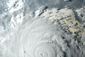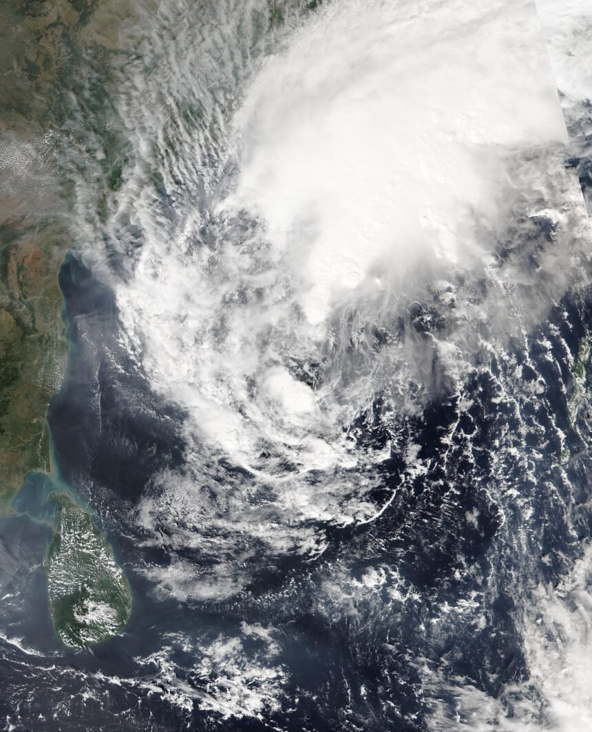
Cyclone Akvan began crossing India’s east coast early on Friday, November 20, after weakening from a severe cyclonic storm into a cyclonic storm, the India Meteorological Department (IMD) said. The storm is expected to cross the north Andhra Pradesh and south Odisha coast close to Gopalpur by Friday forenoon, with sustained winds of 70 to 80 kilometres per hour, gusting to 90 kilometres per hour.
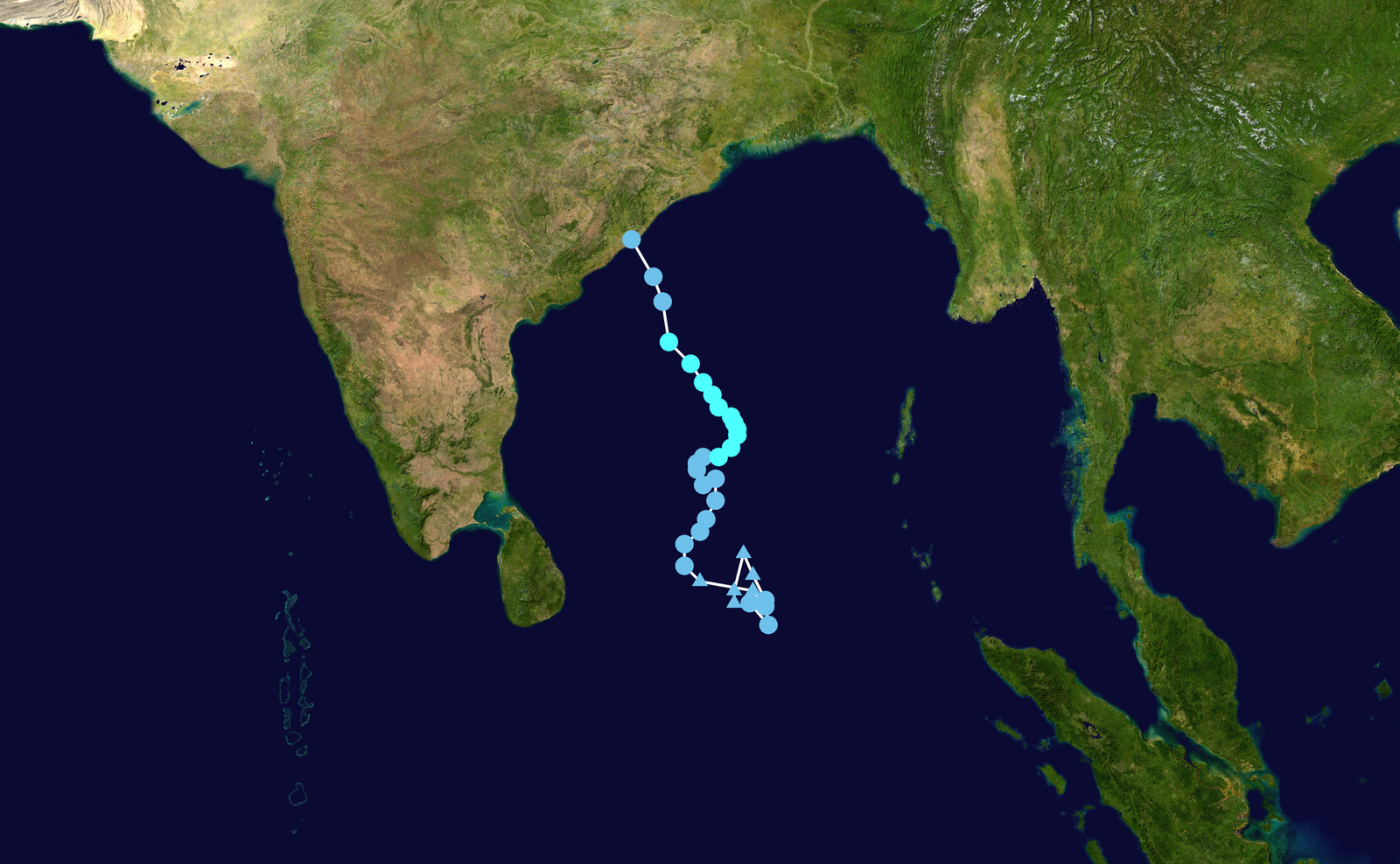
In its 2:30 AM bulletin, the IMD placed the storm’s centre over the west-central Bay of Bengal at 17.7 degrees north and 84.9 degrees east — about 110 kilometres southeast of Kalingapatnam, 170 kilometres east of Visakhapatnam and 170 kilometres south of Gopalpur. The department said land interaction had already begun as the storm’s cloud mass moved over the coast, and the landfall process would continue for several hours.
Read also: Cyclone Akvan Landfall on November 20: Red Alert in Andhra Pradesh, 2 Lakh Evacuated in Odisha
Storm weakens before landfall
The weakening is good news for the coast. On Thursday, the IMD had forecast landfall winds of 90 to 100 kilometres per hour, gusting to 110. The overnight drop in intensity means the wind threat is lower than feared, but the rain threat remains serious. The IMD has warned of heavy to very heavy rain, with isolated extremely heavy rain, across north coastal Andhra Pradesh and south Odisha through the day. The IMD chief has also warned of possible flash floods, with 20 to 30 centimetres of rain in the worst-hit areas.
No deaths had been reported by Friday morning, officials said, though the full impact will only become clear once the landfall process is complete and assessment teams can reach the worst-hit coastal districts.
| Detail | Latest update (IMD bulletin, 2:30 AM, November 20) |
|---|---|
| Storm status | Cyclonic storm (weakened from severe cyclonic storm) |
| Position | 17.7°N, 84.9°E, west-central Bay of Bengal |
| Distance from Gopalpur | About 170 km south |
| Expected landfall | By Friday forenoon, close to Gopalpur, Odisha |
| Wind speed at landfall | 70–80 kmph, gusting to 90 kmph |
| People evacuated in Odisha | Over 3 lakh |
| Rescue teams deployed | 423 |
| Trains cancelled | 69 |
Over 3 lakh people evacuated in Odisha
Odisha has shifted more than 3 lakh people from vulnerable coastal and southern districts to safer places — one of the largest precautionary evacuations in the state in recent years. As many as 423 rescue teams have been deployed, including units of the Odisha Disaster Rapid Action Force (ODRAF), the National Disaster Response Force (NDRF) and the Fire Services. People have been housed in cyclone shelters and relief camps across the affected districts.

Read also: Cyclone Akvan Forms Over the Bay of Bengal: Severe Cyclone Expected by November 17
69 trains cancelled, schools shut, Konark temple closed
The storm has disrupted transport across the region. The East Coast Railway has cancelled 41 trains and rescheduled 29, while the South Eastern Railway has cancelled at least 28 more services, mostly on Puri routes. Among the cancelled trains are the Howrah–Puri–Howrah Vande Bharat Express and several Puri-bound express services. Fishing operations have been suspended along the coast.
Schools, colleges and Anganwadi centres have been ordered shut in 11 Odisha districts as a precaution. The Konark Sun Temple will remain closed from November 19 to 21. The Odisha government has placed 11 districts on red alert, with Ganjam, Malkangiri, Rayagada, Koraput and Kalahandi expected to be among the worst hit.
Red alerts in Andhra Pradesh and Odisha
The IMD has issued a red alert — its highest level, meaning “take action” — for Srikakulam and Vizianagaram districts in Andhra Pradesh, with orange alerts for Parvatipuram Manyam, Alluri Sitharama Raju and Anakapalli, and a yellow alert for Kakinada. In Odisha, a red warning for extremely heavy rain covers Ganjam, Gajapati, Puri, Jagatsinghpur, Kendrapara and Kandhamal districts.
What happens next
Forecasters say Akvan is expected to weaken into a deep depression later on Friday and lose more strength by Saturday morning. Heavy rain and strong winds could, however, continue to affect inland areas even after the storm crosses the coast. The exact timing, location and intensity of the landfall may still change, so residents should follow official IMD updates and local administration advisories, avoid coastal areas and stay away from the sea until the all-clear is given.
Figures in this report are based on IMD bulletins issued on November 20, 2026, as reported by national media. Landfall details may be updated as the situation develops.